The C1 Circular Walking Route in Altencelle
Short facts
- start: Altencelle, Ahnsbecker Weg/Im Sande
- destination: Altencelle, Ahnsbecker Weg/Im Sande
- medium
- 14,82 km
- 3 hours 36 minutes
- 29 m
- 53 m
- 37 m
- Walking / hiking
best season
Explore the more than 1,000 year old history of Old Celle
Find out where the Allerfurt and Brunonenburg once lay. Stroll through the heart of the medieval town centre featuring typical farmhouses of the period. Marvel at old, gnarled oaks that accompany you on your way. In the surrounding area enjoy far-reaching views over the vale of the Aller Valley, you’ll come across the tracks of the old Aller Valley railway line and discover a wooded dune.


General information
informations
- Labelling
- Cultural Interesting
- Loop Road
Directions
Circular Route through Old Celle, via Osterlog and Bockelskamp, appr. 15km
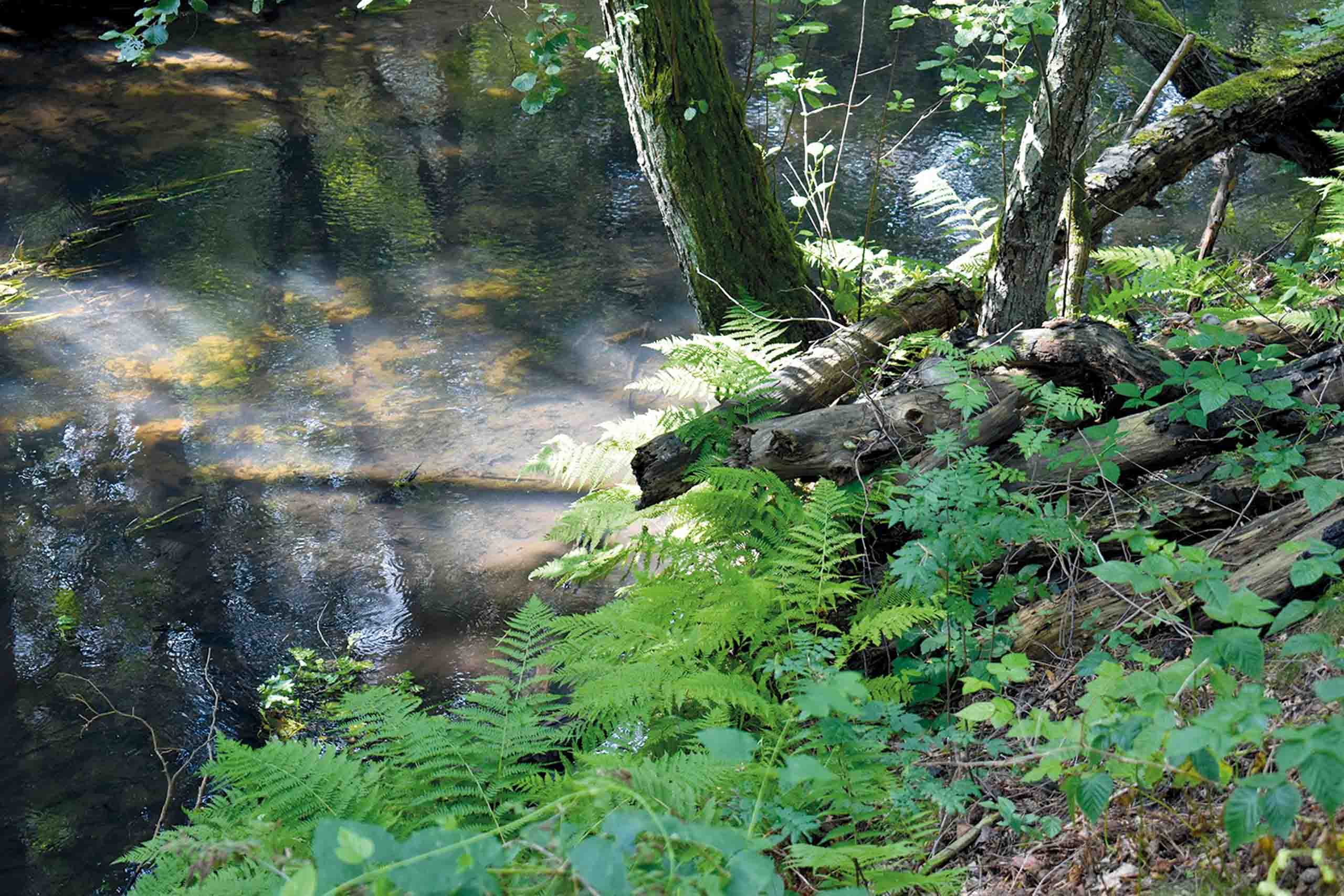
Our walk in search of traces of history starts in a small clearing in the forest just northeast of Old Celle. An information board marks the starting point. From here, we follow the Osterbruch Canal, initially on a wide path, from which a narrow path soon branches off to the left. The crowns of oaks, pines, alders and birches spread out above us, the floor is covered with a carpet of blueberry plants. The canal cuts deeper and deeper into the ground, although with the dense vegetation on the banks, it now looks more like a stream. Only its rigid straight course reminds us that this is a man-made trench. At the picturesque riverside rest area, there is an information board which explains the history of the forest.
Lined with old oaks, our path leads south along the edge of the forest. We experience an exciting change in landscape, contrasting between forest and fields.
Soon the path runs parallel to a rising elevation in the landscape: the Osterloh Alps. This huge mountain of sand was once blown onto the banks of the Aller river. At the top of this mound, a shifting pathway offers wonderful views across the floor of the Aller Valley. Here, man has given a piece of nature back to the river: Follow the signs to the NABU project to discover the beauty and biodiversity of this area of renaturation and rewilding.
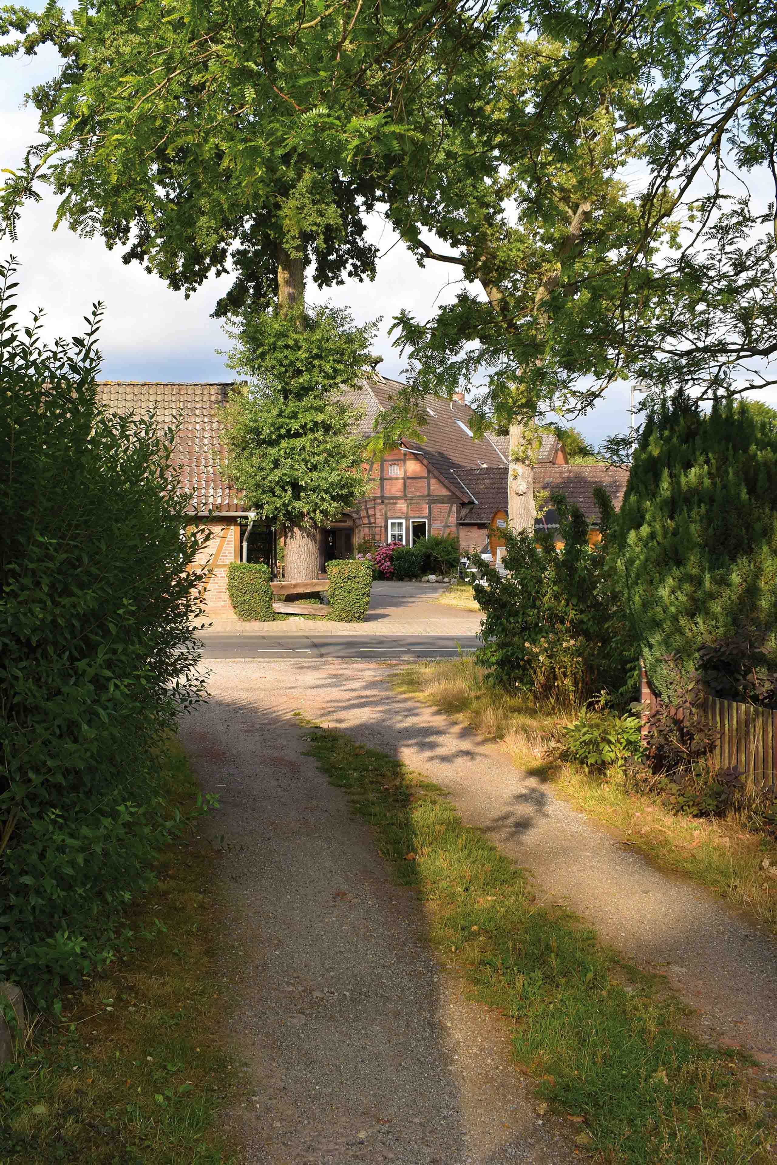
The circular route continues to Osterloh, which welcomes us with a mixture of the highly traditional style homes in the area known as ‘Heidehöfe’ and other styles, such as more modern villas.
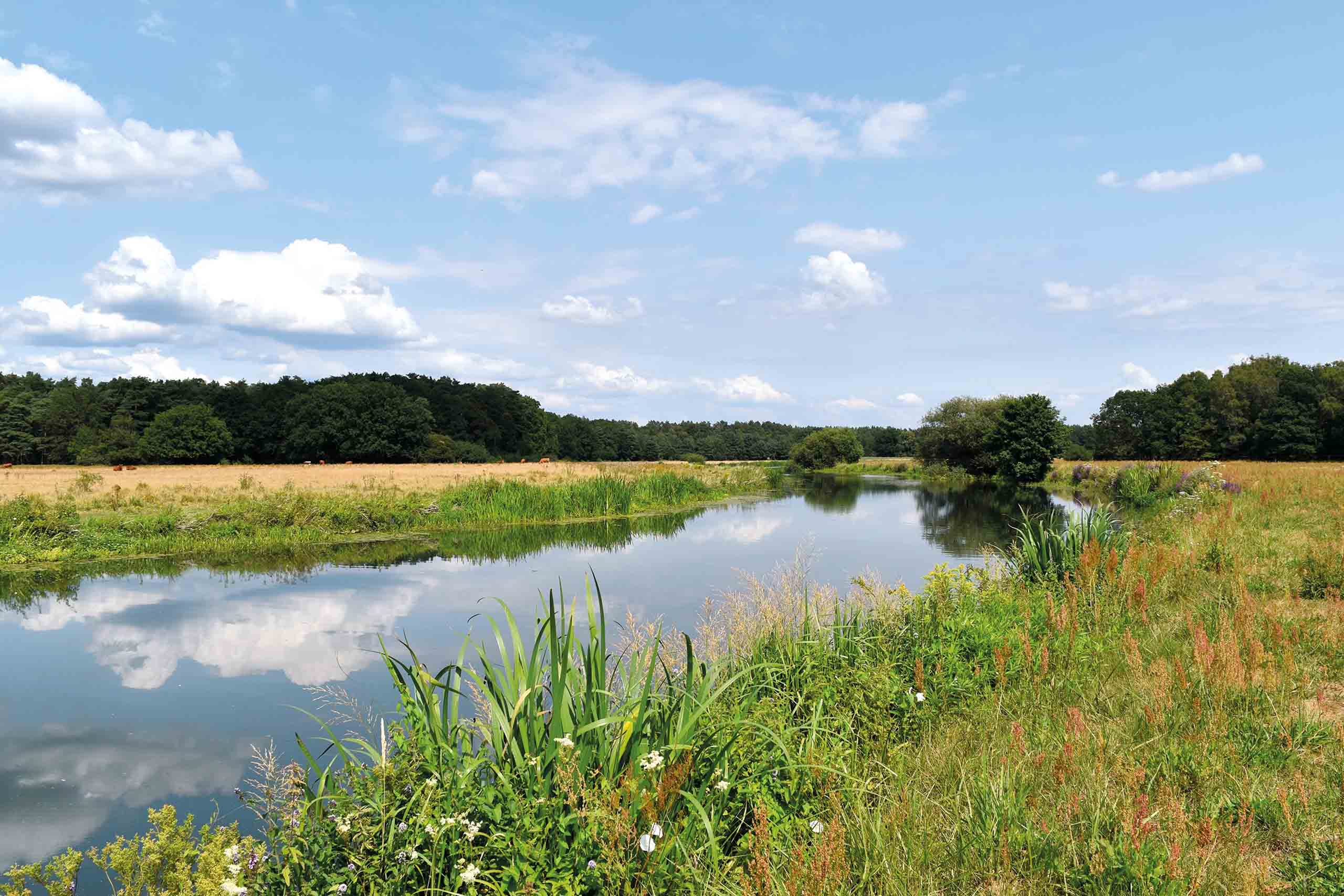
We leave the village in a southerly direction and meet the Osterloher dam at a bend in the revitalised river Aller. Accompanied by a panoramic view of the floodplain, we hike along the course of the river over fields and meadows. Shortly before Bockelskamp we come across a covered barbecue area.
At Bockelskamp we turn right and run parallel to the old railway embankment of the former Aller Valley railway line, which once ran from the town of Gifhorn via Celle to Verden. The section you see here opened in 1913. The last freight trains on this route ran in 1993. Through a small wood we get to the open field, where our route borders the industrial area of Old Celle. This is where the agricultural and industrial meet: the large purpose-built industrial buildings of well-known companies on the left, chickens and geese on the right of our route, pecking and grazing their way here and there around mobile coops.
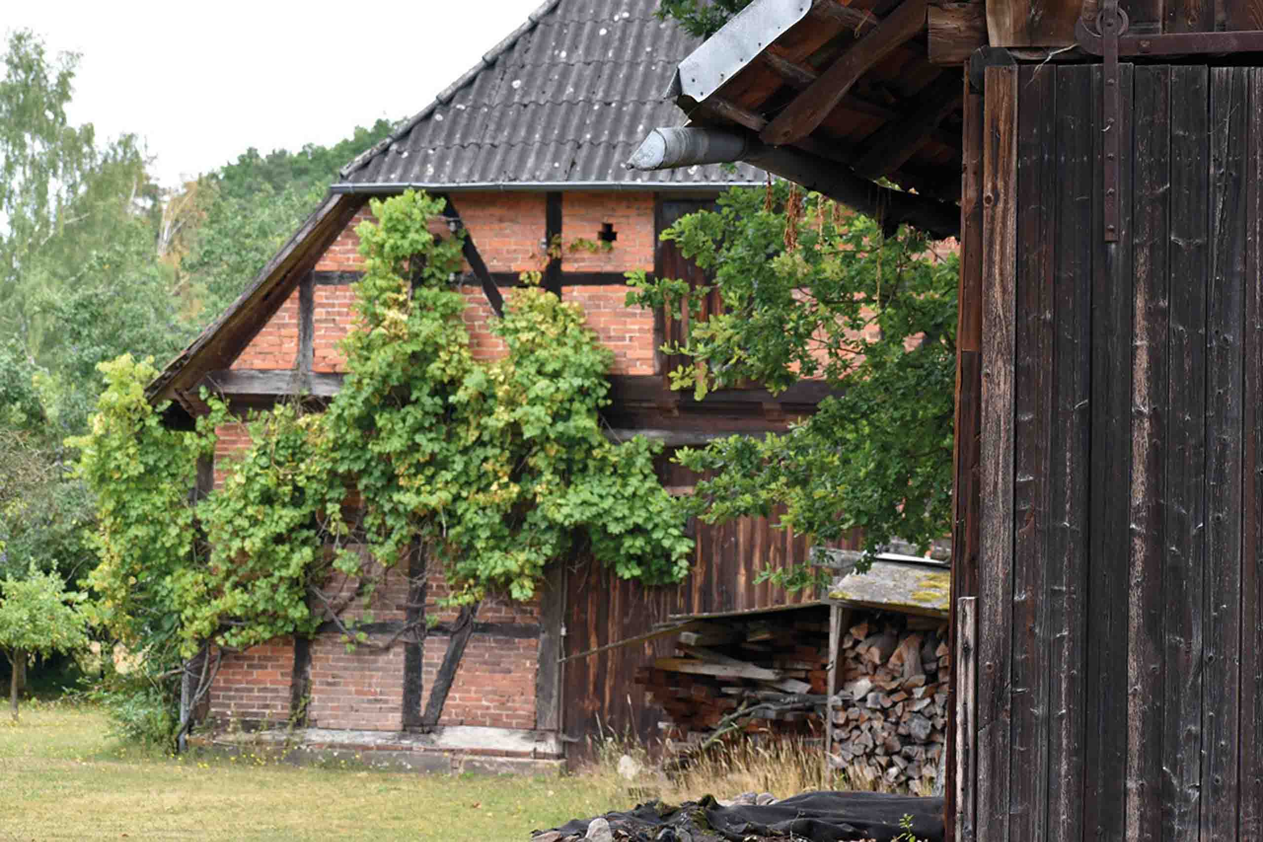
We now reach Old Celle and hike along its eastern edge, from which there are frequently views of fields, meadows and the course of the river. Don't miss the next stop where you can find information about the historical Nienburg. The most recent excavations (in 2013/14) showed that a farmstead had stood there since the early Iron Age and not - as long suspected - a fortress of Charlemagne. Through the new housing area, follow the signs to the historic centre of Old Celle. Traditional old heathland farm buildings and courtyards await us in the shade of gnarled oaks and a small square, where an historic village market is held each year. Close by, family-run farm shops invite you to buy organic and other farm produce.
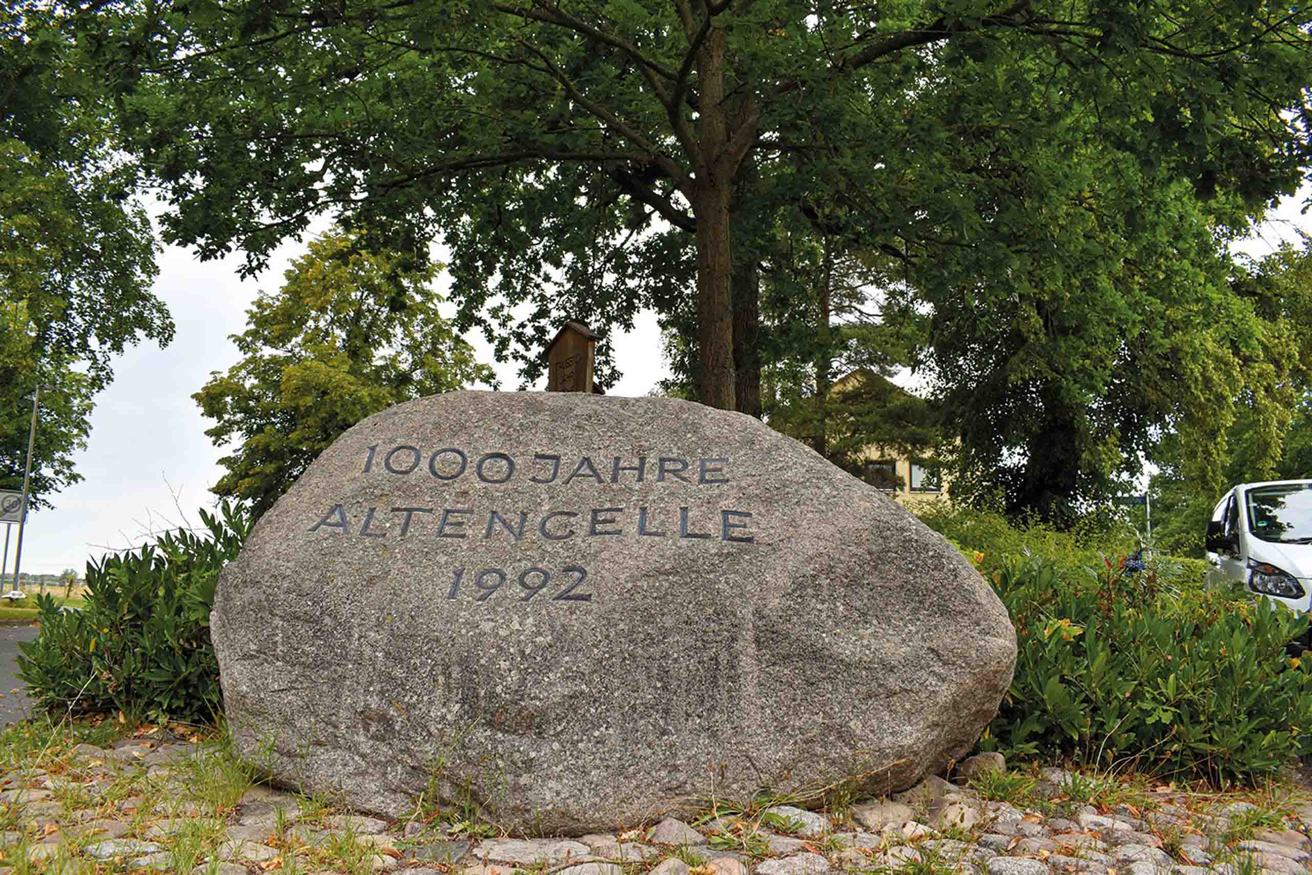
Our way now takes us past the monument celebrating "1000 years of Old Celle". This memorial stone and the newly planted oak mark the 1000th anniversary in 1992. We reach the Gertrudenkirche (St. Gertrude’s Church), which was originally in the centre of historical Old Celle. After Celle was relocated around 1292, the church lost its importance and fell into disrepair. Evidence from the time of its reconstruction in the 14th century shows, among other things, Gothic elements such as the pointed arch portal or the slender arched windows.
On the question of how far north the original Celle extended from the Gertrudenkirche, new information was revealed during the archaeological excavations from 2012 to 2015. Older studies show that the so-called Brunonenburg was once located on the grounds of today's Schulz-Wallheinke courtyard, the site of the former settlement of “Kellu”. The name “Kellu”, mentioned for the first time in 992, means “bay” (probable comparison: “Kiel”) and refers to the fact that the Aller once flowed through an arch directly through Old Celle. Some insignificant ponds at the wayside are the remains of this old bend in the river’s course. From the Allerbrücke (Aller Bridge) we can take a last look over the river, which shaped people's lives for centuries and which still determines the character of the landscape and the region today.
Safety Guidelines
Stay on the designated trails. Make sure you have enough water to drink.
Equipment
No special equipment is required to do this hike.
Tip
Take provisions for a small picnic with you. Along the way, benches invite you to take a short break. Remember to take your trash back with you.
Getting there
Coming from the direction of Celle/center, turn left into Baker-Hughes-Straße and follow this until you turn right into "Ahnsbecker Weg".
Coming from the direction of Braunschweig (B214), turn into "Große Redder" at the intersection in Altencelle. At the end of the road, turn right again into "Alte Dorfstraße" and follow it until you turn right into "Ahnsbecker Weg".
Parking
The main starting point of the circular trail is Ahnsbecker Weg/Im Sande, where a parking lot has also been prepared.
Public transit
With the buses of CeBus you can travel from Celle to Altencelle. For up-to-date information for your arrival and departure, visit www.cebus-celle.de. There you can get your daily updated timetable information.
possible stop in Celle: Celle Schlossplatz
Stop in Altencelle: Küsterstraße
Our tip: Simply start the circular walk at station 13 by crossing the "Alte Dorfstraße" and following the street "An der Gertrudenkirche".
Track signage
The entire trail is equipped with information and thematic panels. It leads almost exclusively along existing public paths. A red C1 on signposts and marker posts identifies the route.
Additional Information
The circular route crosses two pilgrimage routes, the Way of St. James and the Via Romea, as well as the hiking trail "W4" Wienhausen and the "Aller-Radweg".